
Wow. We’ll go into more detail about Torres del Paine, but that’s the important point: Wow. You know how a picture says a thousand words? This post is going to be a little brief on the words and long on the pictures (edit: wow, was I ever wrong about this … it’s long on both, beware). Because that’s the only possible way to do Torres del Paine justice. If you’re going soon and want to savor the experience yourself, you may want to turn away (coming soon … the things you need to know about TdP that you can’t find out till you get there).
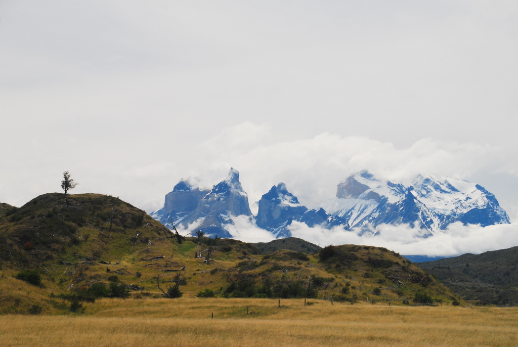
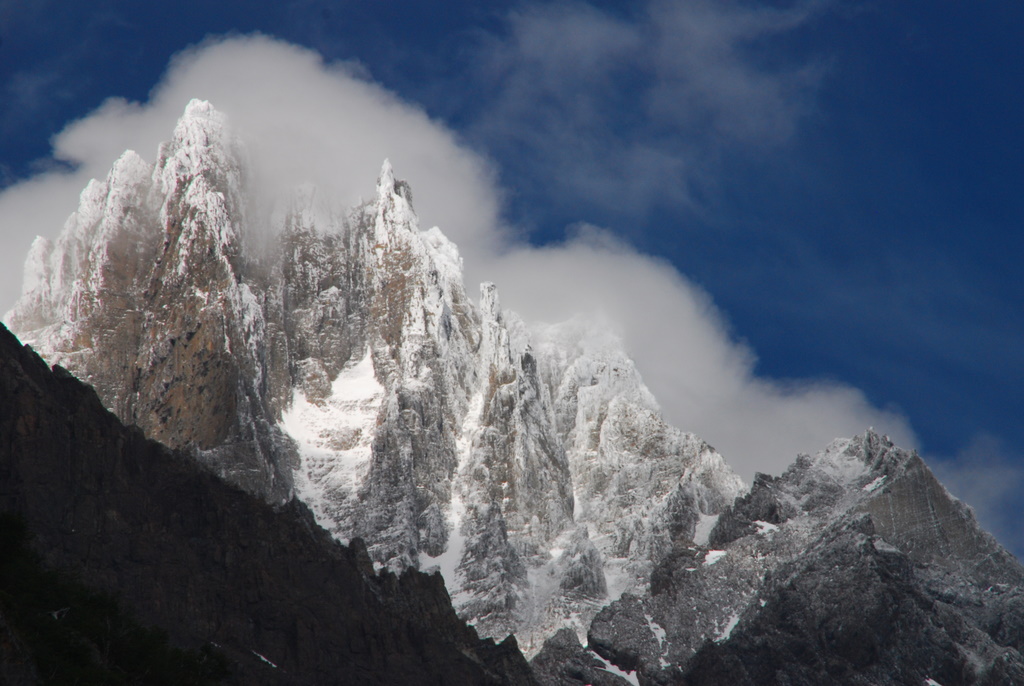
The classic trek through TdP is called ‘The W’. It’s called this because with ~80 kilometers of footsteps, you trace a W into the dirt trail. There are three ways to access this W, via road, via catamaran, and via 17 km trek. We, naturally, chose the arduous way in. We did so because, well, we’re crazy and thought 80 km wasn’t enough, and it gave us the grand perspective of the park as you enter. We were stopping every 10 minutes to take pictures as the cloud cover was constantly revealing and hiding peaks.


We arrived that evening at our first refugio, which, thanks to Theresa, we had booked far enough in advance to ensure a bed. It’s something quite lovely to hike all day, get sweaty, dirty, grimy and smelly, then step into a nice lodge in the evening, have a hot shower, a hot meal, and a Thanksgiving Cerveza Austral Calafate Ale.
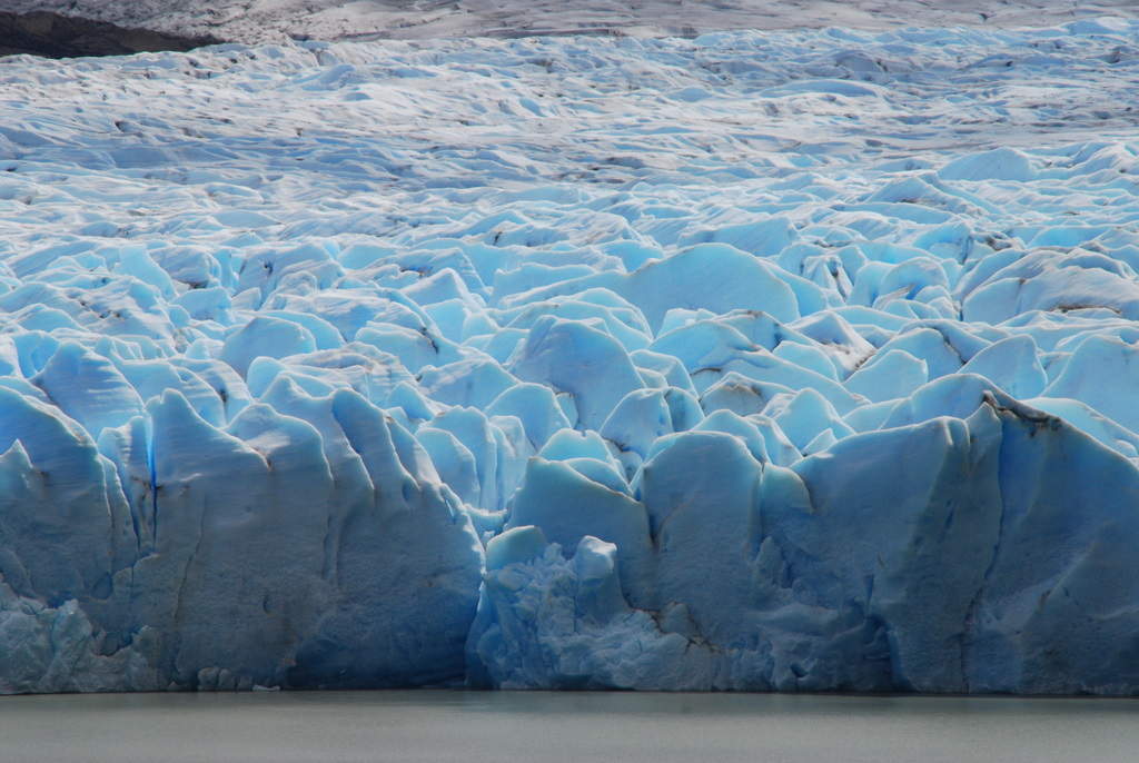
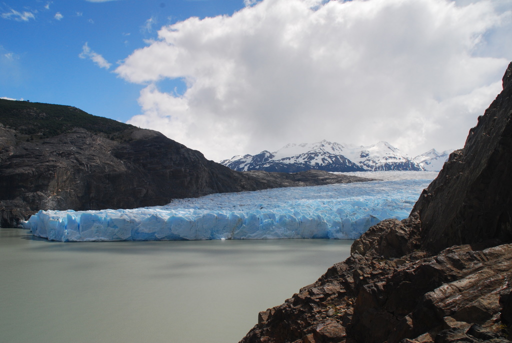
The next morning we started up the left arm of the W, toward glacier Grey, into a cold, fierce wind and occasional outbursts of stinging rain. The rain quickly faded but the wind kept at us all day. We persisted, eventually breaking through to a beautiful long distance overlook, and then, two hours later, the arrival at the glacier.


After marveling at the glacier as long as our cold bodies could stand, we huddled into refugio Grey for a tea and hot chocolate by the fire. It was right about then that I became completely sold on refugios. So what if they cost 2-3 times what they do in the city — they do it smack dab in the middle of nowhere, and always just when you need them most. Re-energized, we decided to head to the next campground for a closer look at the glacier. We got our closer look, but through a most unofficial means: we lost the trail pretty quickly and ended up scrambling over boulders and loose rock, eventually reaching a lookout almost directly above the face of the glacier itself. I’m not sure how we did it (or exactly how we got back), but we lost the trail we were assured was impossible to lose. After our adventure, we returned down the same path back to our same refugio for a second night.


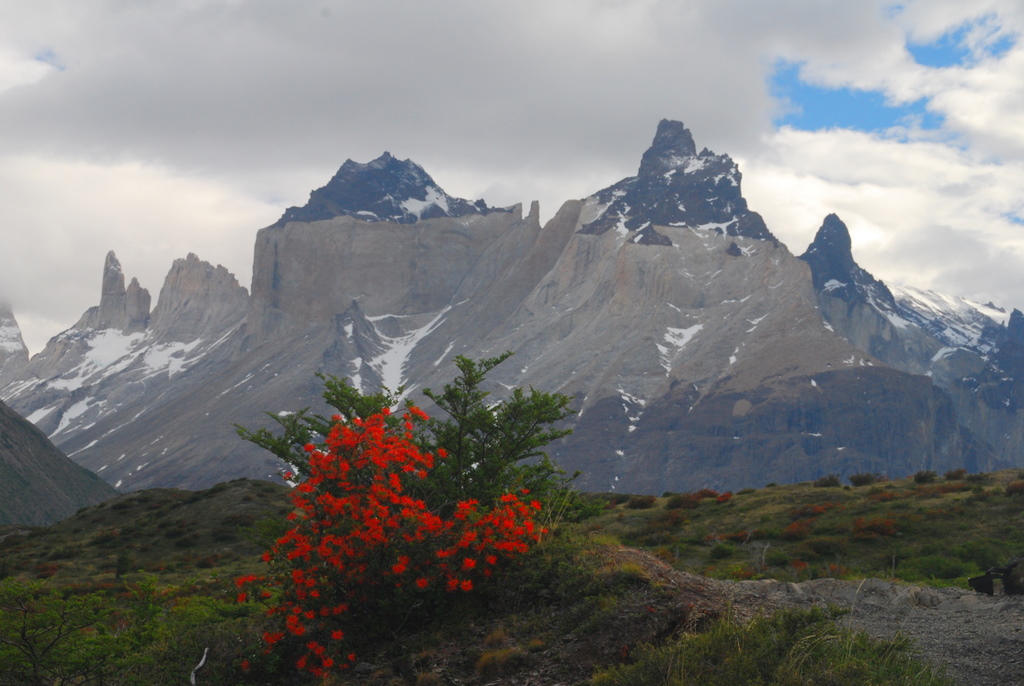
Our third day found us ascending into the middle of the W, Valle Frances. In retrospect, this was the highlight of our trip, and also our hardest day. We started with an easy two hour stroll over to Campamento Italiano, where we ditched our packs (since we’d be returning the same way later) and headed up the valley. As we slowly ascended, we got better and better views of a giant glacier field to our left and the Cuernos, three peaks, to our right.


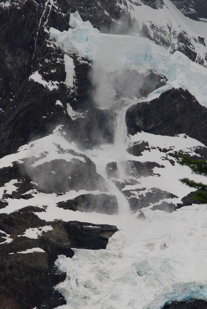
When we first heard a thunderous noise, in D.C. hiking mode, we began to worry about an impending storm, only to look across the valley and see an avalanche streaking down the glacier field. The sight was incredible and the noise defeaning. It kept happening the entire hike, as the afternoon sun wreaked havoc, and we never tired of it.


We reached the valley’s “mirador” – lookout, and found ourselves surrounded by majestic peaks and gorgeous views, then turned around and descended, all the way listening to the music of the glaciers. We retrieved our packs at Campamento Italiano and began our trek to Refugio Los Cuernos, a further two hours walk. About then, a light but steady rain began to fall, soaking the trail and making the already difficult terrain slippery. The conditions, our heavy packs, and the steady procession of peaks and valleys made this section the toughest terrain for us. we fell into the refugio and again, were thankful for a shower and a warm bed to look out at the rain from.
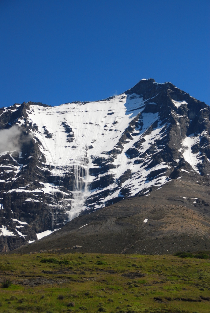
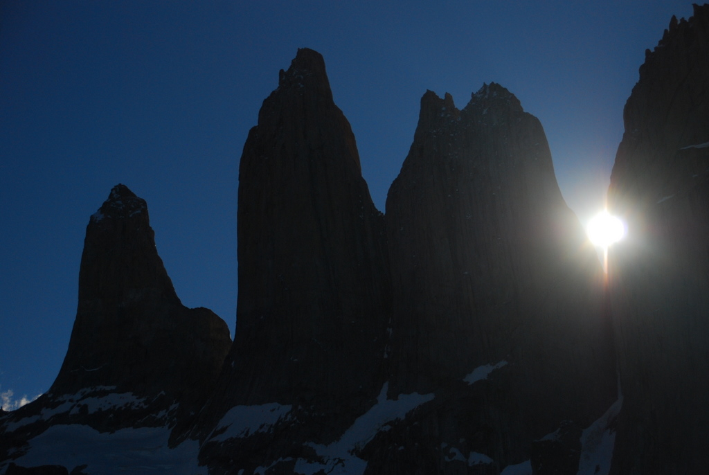
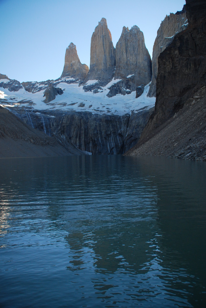
But we really had very good luck with the weather, as we awoke to sunny skies and perfect weather. What some say is the hardest section of hiking we found rather agreeable (though I think the weather had much to do with that – its known for being very windy), as we hiked slowly, then rapidly, gaining altitude through open fields beneath more avalanching glaciers to Refugio Chileno. Arriving early in the afternoon after only five hours of hiking, we decided that given the beautiful weather and the swiftness with which it can change, we’d better hustle up to the park’s namesake – Las Torres – that afternoon. We strolled for an hour through a beautiful forest, then began a mad scramble directly up a boulder field, eventually reaching the “end of the trail” beneath Torre Norte, Torre Central and Torre Sur, the iconic towers of Patagonia.


While we had originally planned to do the typical thing and hike up the next morning for sunrise, to watch the towers “turn red,” we could see some of them from refugio Chileno and I did wake up for sunrise, snapped a few photos and fell back into bed.


We did the hour hike out the next morning, finishing our ~100 kilometers (~60 miles) in four days + 1 hour, and celebrated with an ice cream in the spring sunshine.
So if you’ve made it this far, the only summary I can offer is what I began with: Wow. I hope all the rest of these words have managed to convey some sense of that to you.
You must be logged in to post a comment.